General
The Jatbula Trail is a medium to hard walk for reasonably fit and active people with some bushwalking experience – (Capable of walking over rough ground with up to 15kg backpack). The majority of people walk the trail as independent trekkers with growing numbers doing the trail with a guide for peace of mind and the extra information and experience afforded. There are emergency call devices (ECD) and checkpoint book registers along the way.
“The Jatbula Trail was wonderful – scenery was stunning, every day we camped by fabulous waterfalls and waterholes which seemed to be more beautiful than the last! Every step of the way our guide shared his experiences and knowledge of the bush and its flora and fauna with us. I came away feeling fitter and totally relaxed… and feeling like had made some new friends!” – Mohan Kohli.
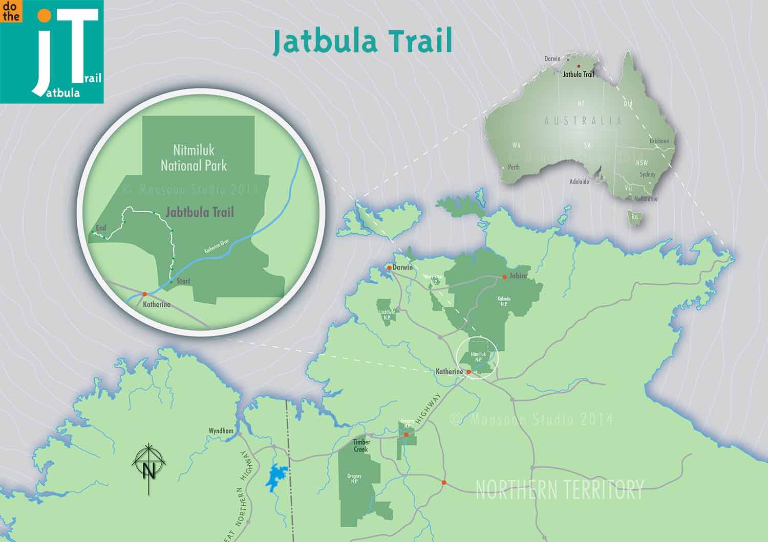
The Katherine Region has many attributes not the least of which is the famous Nitmiluk National Park and a strong indigenous cultural substrate , both of which you can experience on this great walk. The Katherine River is the main feature of this area which has carved Nitmiluk (ne Katherine) Gorge. The Jatbula Trail starts with a short boat trip across the Katherine River (more on this later). From the visitor centre it is possible to do boat tours or hire a canoe to see the first few gorges of the 13 gorge Katherine Gorge.
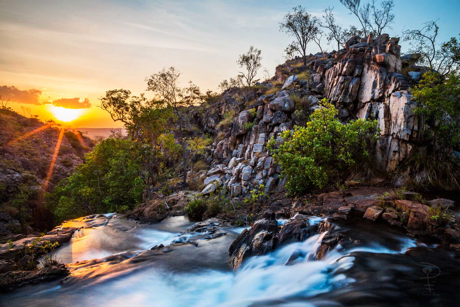
The Jatbula Trail is a trip of a lifetime, giving you the opportunity to walk through Nitmiluk National Park from the famous Nitmiluk Gorge to Leliyn (Edith Falls). The trail is an ancient Song Line used by the Jawoyn people. Overlooking the Seventeen Mile Valley and beyond, the trail features magnificent waterfalls tumbling from the high sandstone escarpment, these then feed into creeks surrounded by shady monsoon forests and the rock outcrops of the escarpment provide great opportunities to view stunning ancient rock art.
Each day brings a walk of between 10 and 17 kilometres with camps reached between 12pm and 2pm each day. On arriving at camp its time to relax, swim, read and enjoy the beauty of your surrounds. Each campsite has its own water source ranging from a small babbling spring fed creek to a 30 metre high waterfall. Each afternoon brings about a different pool or spa to sit back and relax in.
Each day will also present to you a new set of challenges, from river crossings to hill climbs (nothing too big mind), there will be flat open country on the top of the escarpment and boggy wet country along the creeks that we follow. Something new around every corner, whether you are an experienced hiker or just someone who is willing to try something new and exciting.
Logistics
As the walk is run as a one way circuit it is important to organise a way of getting to the start and back from the finish. The walk starts at the Nitmiluk NP visitors centre. This is 30km from the town of Katherine and takes about 25 to 35 mins to drive. The walk ends at Leliyn ( Edith Falls) which is about 60km from Katherine. There is carparking and commercial camping at both Nitmiluk visitors centre and Leliyn Falls. There may be a transfer service run by Gecko Canoeing or a local taxi service available to get you where you need to be if you cant organise your own drops.
A small fee per person is charged for the short boat ride across the Katherine River. The transfer must be booked in advance with Nitmiluk Tours.
Common Itinery
Day 1 Cross the Katherine river to the mouth of 17 Mile Creek via small boat and then walk to Northern Rockhole for a swim and morning tea. 3.8kms. Continue on to Biddlecombe Cascades to camp for the evening. 4.5kms
Day 2 Passing some rock art continue on to Crystal Falls. 11km
Day 3 Crystal Falls to the Amphitheatre 6.5km for morning tea, then moving on from the Amphitheatre to 17 Mile Falls 3.5km
Day 4 Walk to Edith River Crossing for lunch. 11.7km and head on to Sandy Camp Pool for camp. 5.1km
Day 5 Across a couple of creeks and through a bog to Sweetwater Pool. 5.6km Final stage down to Leliyn (Edith Falls) 4.5km